Mitigation Projects
Liberty Island Conservation Bank
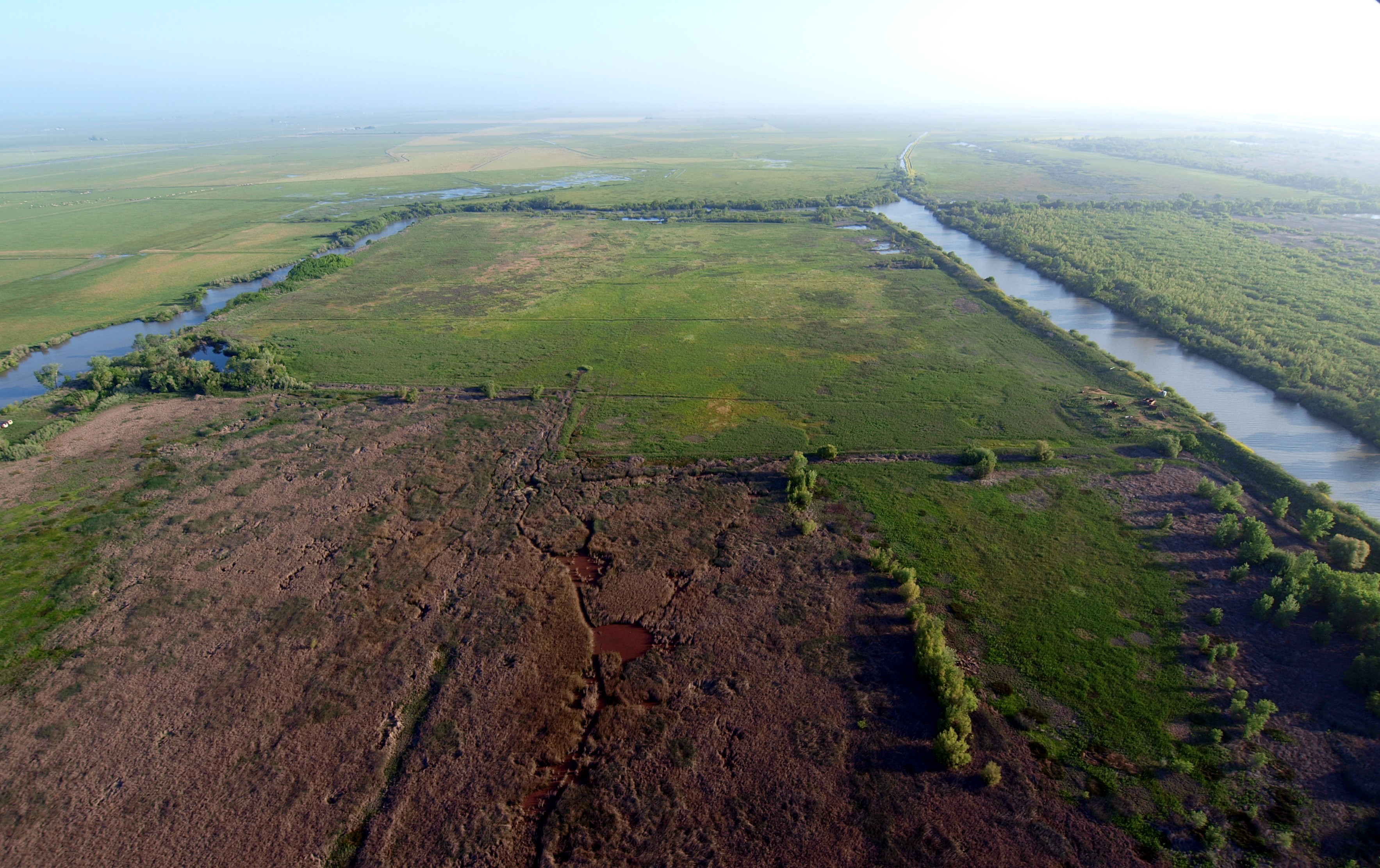
The Liberty Island Conservation Bank (Bank) is located in the southern Yolo Bypass in Yolo County, CA. The Bank is centrally located at the lower end of the Yolo Bypass just west of the Port of Sacramento Deepwater Shipping Channel in the tidal Delta, approximately five miles west of the Community of Courtland and 10 miles north of the City of Rio Vista.
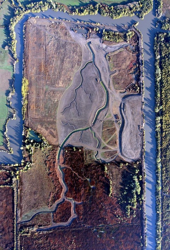
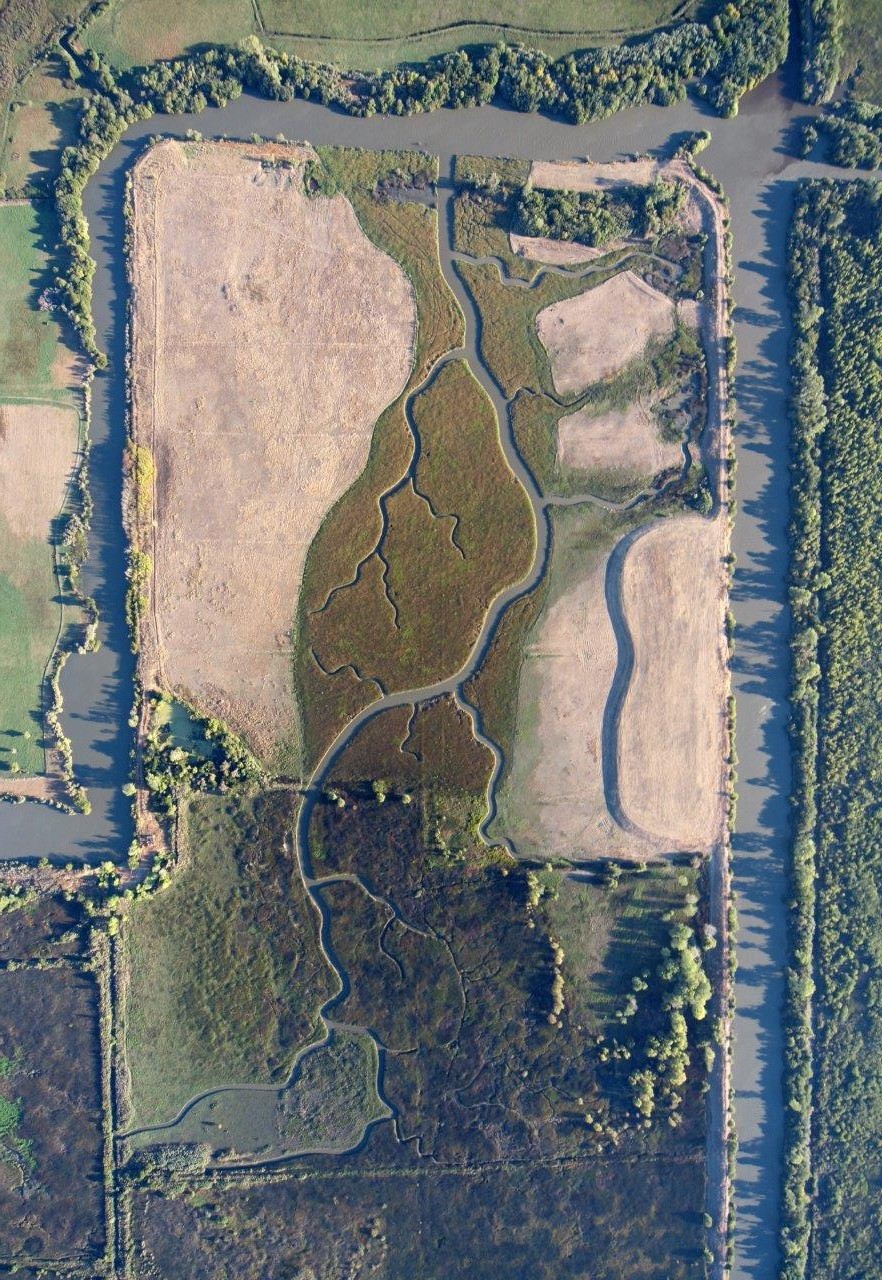
Prior to 1997, Liberty Island was a 10-square-mile island in agricultural production due to its maintained levees. At its agricultural peak, Liberty Island had paved roads, power and telephone lines, homes, farm buildings, and even a school. The private levees protecting the island failed numerous times over the years. After each levee failure the residents of Liberty Island reclaimed their farms until the floods of 1997. After the floods of 1997, agricultural production and the community it supported was finished, and the island was allowed to begin the long reversion to its natural state. Today the majority of the 5,000-acre Liberty Island is flooded and only the northern 1,000 acres are without permanently inundated levees.
The Bank consists of 186 acres located on the still leveed northernmost tip of Liberty Island. Approved in July 2010 by the National Marine Fisheries Service, U.S. Fish and Wildlife Service, and the California Department of Fish and Wildlife, the Bank provides compensatory mitigation for permitted projects affecting special-status Delta fish species within the region. The Bank provides habitat for all Delta fish species including: the federally endangered Sacramento River winter-run Chinook salmon; the federally threatened Central Valley spring-run Chinook salmon, California Central Valley Steelhead, delta smelt, and Central Valley fall- and late fall-run Chinook salmon, federal species of concern.
Construction
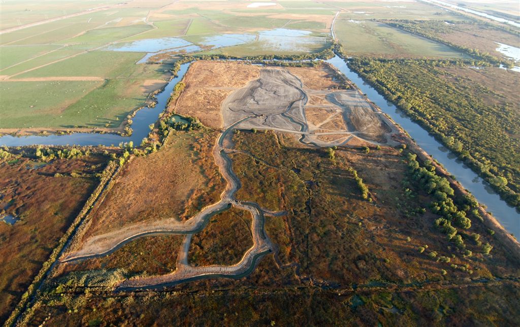
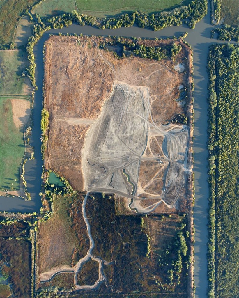
- Construction of the restored habitat included the removal of approximately 1,800 linear feet of agricultural levee, the removal of 2,390 linear feet of interior agricultural berms, and the excavation of approximately 40 acres of tidal marsh. These activities restored the daily tidal inundation of north Liberty Island for the enhancement and restoration of Delta fisheries habitat, while at the same time providing flood system benefits.
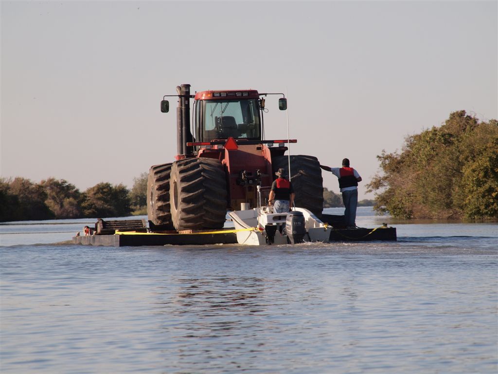
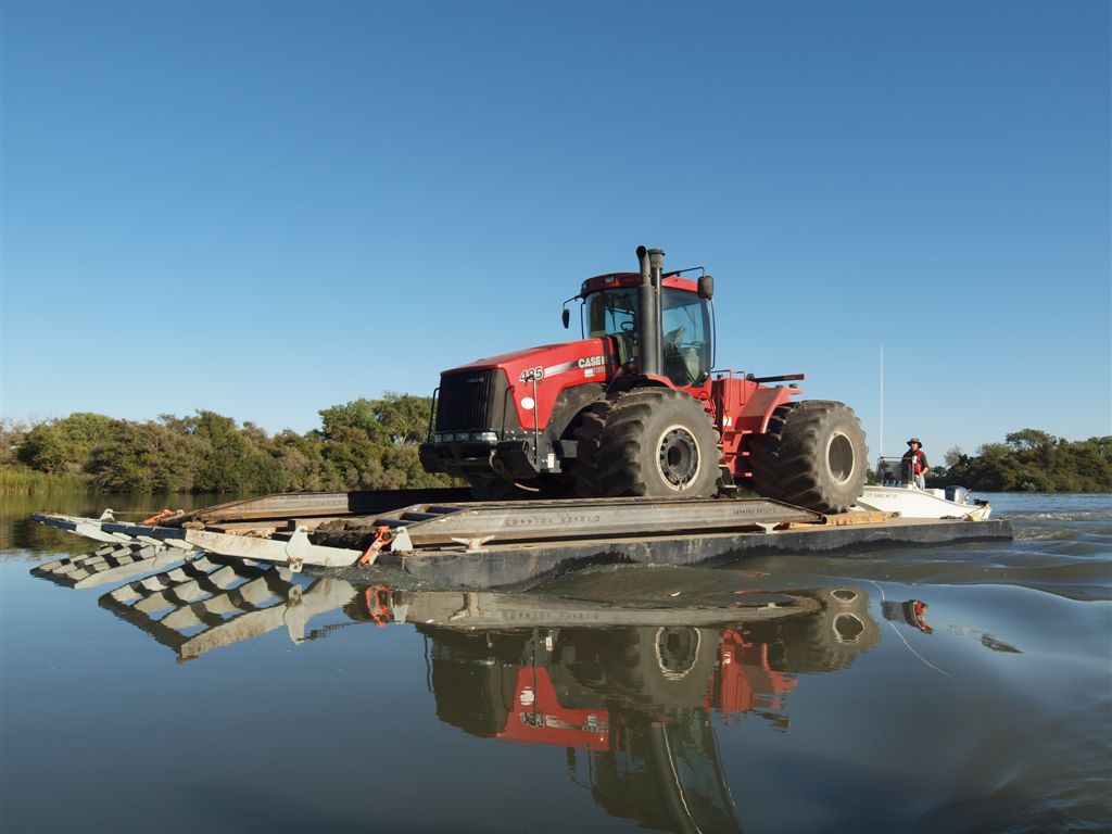
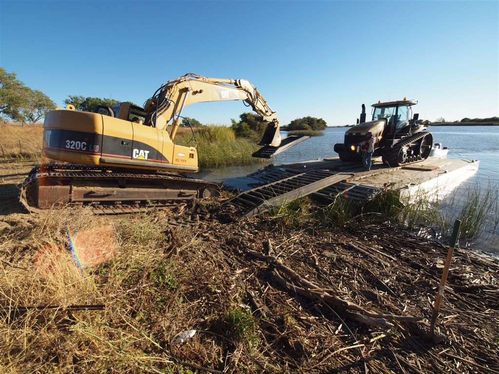
- Construction involved a complicated mobilization process that included barging equipment to the island due to the lack of overland access. Careful sequencing had to be maintained throughout the construction process to allow access to both sides of the constructed channels and maintain dry working conditions until the final levee breach. Global Positioning System (GPS) technology guided the equipment operator and construction equipment by using a 3-D model of the design uploaded into the equipment’s computer. This technology guaranteed that the work was completed at the exact location, depth, grade, elevation, and specifications contemplated in the construction design.
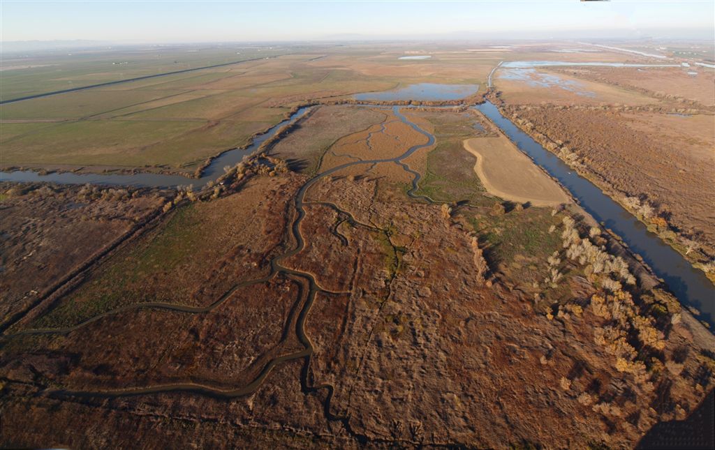
Gallery
186 acres
Location: Yolo County, California
Mitigation Types
- Salmonids
- Longfin Smelt
- Delta Smelt
- Riparian
- Green Sturgeon
Service Area
- The Salmonid and Delta Smelt service area includes the boundaries of the legal Delta. This service area also provides Riparian SRA (shaded riverine aquatic) habitat and Tule Marsh SRA habitat.
- The Longfin Smelt service area includes the entire legal Delta, Honker Bay, Suisun Bay, Grizzly Bay, San Pablo Bay, San Francisco Bay, the Napa River and any other major tributaries deemed appropriate by the California Department of Fish and Wildlife.
-Green Sturgeon - IN ENTITLEMENT, CALL FOR AVAILABILITY -
Approving Agencies
- U.S. Fish & Wildlife Service
- California Department of Fish & Wildlife
- National Marine Fisheries Service
For additional information on the Liberty Island Conservation Bank, please contact Julie Maddox at (916) 435-3555 or jmaddox@heronpacific.com.